
- Startseite >
- Flüsse >
- Wasserstand >
- Bayern >
- Grafentraubach >
- Jahresgrafik

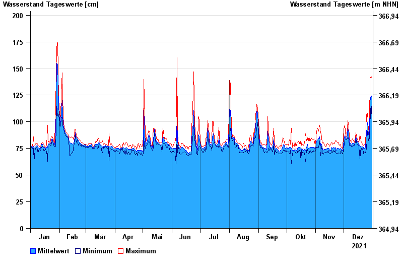
Jahresgrafik Grafentraubach / Kleine Laber
Wasserstand vom 01.01.2021 bis zum 31.12.2021
 Für diesen Pegel sind keine Hochwassermarken hinterlegt.
Achtung
Daten werden aktuell nur stündlich erfasst und 1x täglich übertragen
| Datum | Mittelwert [cm] | Maximum [cm] | Minimum [cm] |
|---|---|---|---|
| 31.12.2021 | 123 | 143 | 104 |
| 30.12.2021 | 125 | 141 | 118 |
| 29.12.2021 | 119 | 142 | 98 |
| 28.12.2021 | 87 | 98 | 84 |
| 27.12.2021 | 88 | 92 | 82 |
| 26.12.2021 | 99 | 108 | 91 |
| 25.12.2021 | 90 | 107 | 75 |
© Bayerisches Landesamt für Umwelt 2025