
- Startseite >
- Flüsse >
- Wasserstand >
- Bayern >
- Hohenstadt >
- Jahresgrafik

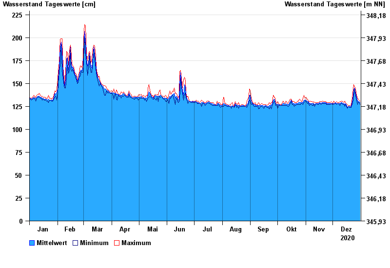
Jahresgrafik Hohenstadt / Pegnitz
Wasserstand vom 01.01.2020 bis zum 31.12.2020
- 23.02.1970 Wasserstand: 311 cm
- 14.01.2011 Wasserstand: 307 cm
- 07.06.1984 Wasserstand: 305 cm
- 28.01.2002 Wasserstand: 303 cm
- 04.06.1971 Wasserstand: 303 cm
| Datum | Mittelwert [cm] | Maximum [cm] | Minimum [cm] |
|---|---|---|---|
| 31.12.2020 | 129 | 131 | 127 |
| 30.12.2020 | 130 | 132 | 129 |
| 29.12.2020 | 131 | 133 | 129 |
| 28.12.2020 | 131 | 134 | 127 |
| 27.12.2020 | 135 | 137 | 132 |
| 26.12.2020 | 140 | 144 | 136 |
| 25.12.2020 | 145 | 146 | 144 |
© Bayerisches Landesamt für Umwelt 2025