
- Startseite >
- Flüsse >
- Wasserstand >
- Bayern >
- Hohenstadt >
- Jahresgrafik

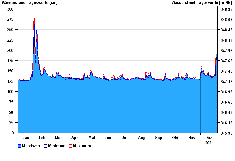
Jahresgrafik Hohenstadt / Pegnitz
Wasserstand vom 01.01.2021 bis zum 31.12.2021
- 23.02.1970 Wasserstand: 311 cm
- 14.01.2011 Wasserstand: 307 cm
- 07.06.1984 Wasserstand: 305 cm
- 28.01.2002 Wasserstand: 303 cm
- 04.06.1971 Wasserstand: 303 cm
| Datum | Mittelwert [cm] | Maximum [cm] | Minimum [cm] |
|---|---|---|---|
| 31.12.2021 | 189 | 198 | 173 |
| 30.12.2021 | 192 | 198 | 188 |
| 29.12.2021 | 180 | 189 | 171 |
| 28.12.2021 | 147 | 171 | 138 |
| 27.12.2021 | 139 | 141 | 137 |
| 26.12.2021 | 139 | 142 | 136 |
| 25.12.2021 | 138 | 141 | 134 |
© Bayerisches Landesamt für Umwelt 2025