
- Startseite >
- Flüsse >
- Wasserstand >
- Bayern >
- Schwürbitz >
- Jahresgrafik

Jahresgrafik Schwürbitz / Main
Wasserstand vom 01.01.2021 bis zum 31.12.2021
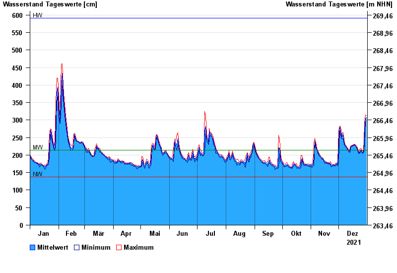
| Datum | Mittelwert [cm] | Maximum [cm] | Minimum [cm] |
|---|---|---|---|
| 31.12.2021 | 307 | 313 | 297 |
| 30.12.2021 | 305 | 314 | 295 |
| 29.12.2021 | 274 | 295 | 235 |
| 28.12.2021 | 218 | 235 | 210 |
| 27.12.2021 | 206 | 210 | 205 |
| 26.12.2021 | 209 | 213 | 206 |
| 25.12.2021 | 216 | 218 | 213 |
© Bayerisches Landesamt für Umwelt 2025