
- Startseite >
- Flüsse >
- Wasserstand >
- Oberer Main - Elbe >
- Rieblich >
- Jahresgrafik

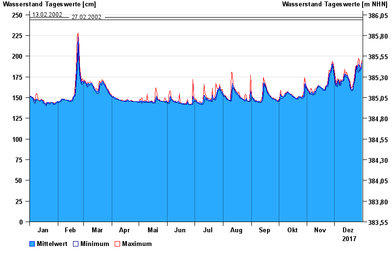
Jahresgrafik Rieblich / Rodach
Wasserstand vom 01.01.2017 bis zum 31.12.2017
- 03.01.2003 Wasserstand: 261 cm
- 30.01.1995 Wasserstand: 260 cm
- 27.01.2002 Wasserstand: 257 cm
- 13.02.2002 Wasserstand: 247 cm
- 27.02.2002 Wasserstand: 244 cm
| Datum | Mittelwert [cm] | Maximum [cm] | Minimum [cm] |
|---|---|---|---|
| 31.12.2017 | 192 | 195 | 186 |
| 30.12.2017 | 185 | 186 | 184 |
| 29.12.2017 | 185 | 186 | 182 |
| 28.12.2017 | 189 | 195 | 184 |
| 27.12.2017 | 190 | 197 | 180 |
| 26.12.2017 | 185 | 187 | 182 |
| 25.12.2017 | 189 | 189 | 187 |
© Bayerisches Landesamt für Umwelt 2024