
- Startseite >
- Flüsse >
- Wasserstand >
- Oberer Main - Elbe >
- Untersteinach >
- Aktuelle Messwerte

Aktuelle Messwerte Untersteinach / Schorgast
Wasserstand vom 24.01.2022 bis zum 31.01.2022
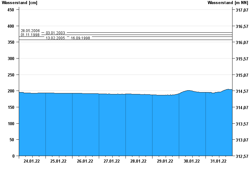
- 28.05.2006 Wasserstand: 379 cm
- 03.01.2003 Wasserstand: 373 cm
- 01.11.1998 Wasserstand: 367 cm
- 13.02.2005 Wasserstand: 357 cm
- 16.09.1998 Wasserstand: 357 cm
| Datum | Wasserstand [cm] |
|---|---|
| 31.01.2022 23:45 | 204 |
| 31.01.2022 23:30 | 204 |
| 31.01.2022 23:15 | 204 |
| 31.01.2022 23:00 | 204 |
| 31.01.2022 22:45 | 204 |
| 31.01.2022 22:30 | 204 |
| 31.01.2022 22:15 | 204 |
© Bayerisches Landesamt für Umwelt 2024