
- Startseite >
- Flüsse >
- Wasserstand >
- Inn >
- Staufeneck >
- Jahresgrafik

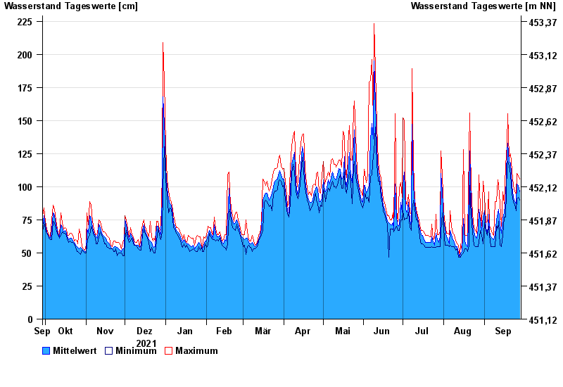
Jahresgrafik Staufeneck / Saalach
Wasserstand vom 29.09.2021 bis zum 28.09.2022
- 14.09.1899 Wasserstand: 551 cm
- 05.07.1918 Wasserstand: 494 cm
- 07.09.1920 Wasserstand: 489 cm
- 07.08.1905 Wasserstand: 486 cm
- 31.07.1924 Wasserstand: 481 cm
| Datum | Mittelwert [cm] | Maximum [cm] | Minimum [cm] |
|---|---|---|---|
| 28.09.2022 | 96 | 106 | 90 |
| 27.09.2022 | 101 | 108 | 92 |
| 26.09.2022 | 102 | 110 | 91 |
| 25.09.2022 | 87 | 94 | 82 |
| 24.09.2022 | 89 | 96 | 86 |
| 23.09.2022 | 92 | 101 | 88 |
| 22.09.2022 | 101 | 112 | 95 |
© Bayerisches Landesamt für Umwelt 2024