
- Startseite >
- Flüsse >
- Wasserstand >
- Obere Donau >
- Heroldingen >
- Jahresgrafik

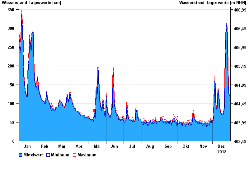
Jahresgrafik Heroldingen / Wörnitz
Wasserstand vom 01.01.2018 bis zum 31.12.2018
- 21.12.1993 Wasserstand: 484 cm
- 14.04.1994 Wasserstand: 482 cm
- 30.10.1998 Wasserstand: 416 cm
- 17.03.1988 Wasserstand: 415 cm
- 31.01.1982 Wasserstand: 395 cm
| Datum | Mittelwert [cm] | Maximum [cm] | Minimum [cm] |
|---|---|---|---|
| 31.12.2018 | 121 | 122 | 120 |
| 30.12.2018 | 123 | 126 | 122 |
| 29.12.2018 | 132 | 142 | 126 |
| 28.12.2018 | 160 | 201 | 142 |
| 27.12.2018 | 256 | 290 | 201 |
| 26.12.2018 | 302 | 309 | 290 |
| 25.12.2018 | 310 | 314 | 301 |
© Bayerisches Landesamt für Umwelt 2025