
- Startseite >
- Flüsse >
- Wasserstand >
- Unterer Main >
- Donauwörth >
- Monatsgrafik

Monatsgrafik Donauwörth / Donau
Wasserstand vom 25.09.2020 bis zum 24.10.2020
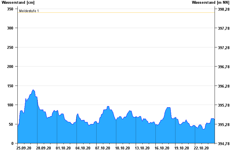
- Meldestufe 1 340 cm
- Meldestufe 2 460 cm
- Meldestufe 3 500 cm
- Meldestufe 4 540 cm
- Hochwassergefahrenfläche HQ100 580 cm
| Datum | Wasserstand [cm] |
|---|---|
| 25.10.2020 00:45 | 58 |
| 25.10.2020 00:30 | 58 |
| 25.10.2020 00:15 | 58 |
| 25.10.2020 00:00 | 58 |
| 24.10.2020 23:45 | 58 |
| 24.10.2020 23:30 | 59 |
| 24.10.2020 23:15 | 59 |
© Bayerisches Landesamt für Umwelt 2024