
- Startseite >
- Flüsse >
- Wasserstand >
- Naab - Regen >
- Plattling >
- Jahresgrafik

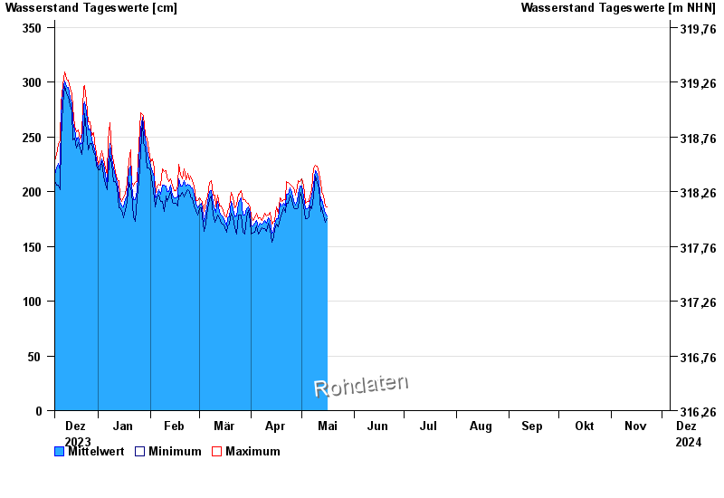
Jahresgrafik Plattling / Isar
Wasserstand vom 06.12.2023 bis zum 05.12.2024
| Datum | Mittelwert [cm] | Maximum [cm] | Minimum [cm] |
|---|---|---|---|
| 13.07.2024 | 226 | 230 | 215 |
| 12.07.2024 | 226 | 238 | 208 |
| 11.07.2024 | 206 | 219 | 193 |
| 10.07.2024 | 218 | 221 | 209 |
| 09.07.2024 | 227 | 233 | 219 |
| 08.07.2024 | 234 | 243 | 226 |
| 07.07.2024 | 225 | 236 | 218 |
© Bayerisches Landesamt für Umwelt 2024