
- Startseite >
- Flüsse >
- Wasserstand >
- Untere Donau >
- Plattling >
- Jahresgrafik

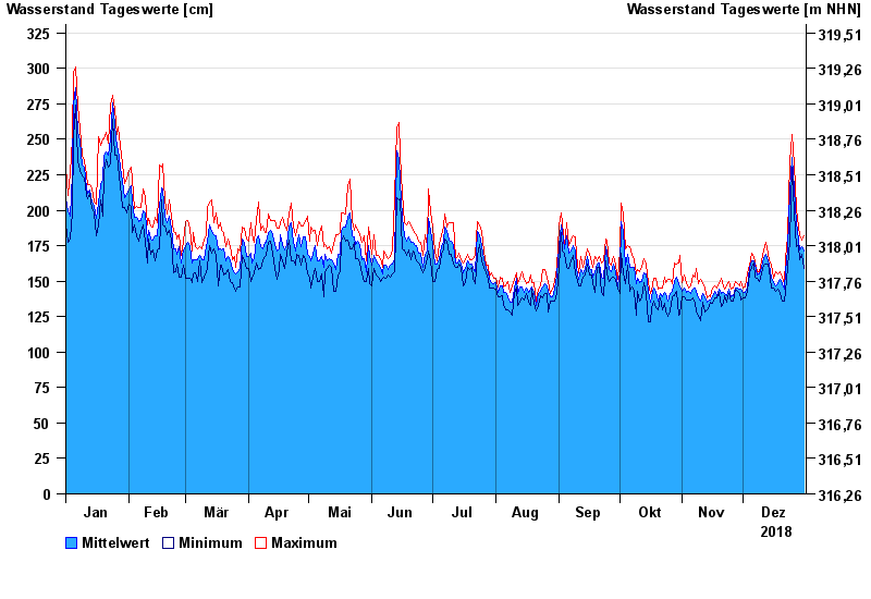
Jahresgrafik Plattling / Isar
Wasserstand vom 01.01.2018 bis zum 31.12.2018
- 04.06.2013 Wasserstand: 400 cm
- 02.06.1940 Wasserstand: 399 cm
- 11.07.1954 Wasserstand: 384 cm
- 24.05.1999 Wasserstand: 378 cm
- 25.08.2005 Wasserstand: 374 cm
| Datum | Mittelwert [cm] | Maximum [cm] | Minimum [cm] |
|---|---|---|---|
| 31.12.2018 | 171 | 182 | 159 |
| 30.12.2018 | 174 | 179 | 169 |
| 29.12.2018 | 172 | 182 | 165 |
| 28.12.2018 | 179 | 188 | 175 |
| 27.12.2018 | 191 | 201 | 174 |
| 26.12.2018 | 215 | 233 | 198 |
| 25.12.2018 | 237 | 253 | 230 |
© Bayerisches Landesamt für Umwelt 2024