
- Startseite >
- Flüsse >
- Wasserstand >
- Untere Donau >
- Plattling >
- Jahresgrafik

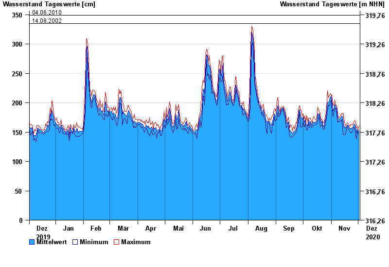
Jahresgrafik Plattling / Isar
Wasserstand vom 03.12.2019 bis zum 02.12.2020
- 04.06.2013 Wasserstand: 400 cm
- 02.06.1940 Wasserstand: 399 cm
- 11.07.1954 Wasserstand: 384 cm
- 24.05.1999 Wasserstand: 378 cm
- 25.08.2005 Wasserstand: 374 cm
| Datum | Mittelwert [cm] | Maximum [cm] | Minimum [cm] |
|---|---|---|---|
| 02.12.2020 | 152 | 160 | 148 |
| 01.12.2020 | 152 | 155 | 148 |
| 30.11.2020 | 155 | 160 | 151 |
| 29.11.2020 | 149 | 157 | 139 |
| 28.11.2020 | 158 | 166 | 143 |
| 27.11.2020 | 164 | 170 | 158 |
| 26.11.2020 | 162 | 166 | 158 |
© Bayerisches Landesamt für Umwelt 2024