
- Startseite >
- Grundwasser >
- Wasserstand oberes Stockwerk >
- Bayern >
- Isarvorland P2 >
- Gesamtzeitraum

Gesamtzeitraum Isarvorland P2
Grundwasserstände im Gesamtzeitraum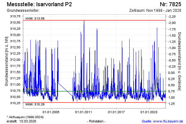
Hinweis
GW Messstelle im SN Isarvorland
Grundwasserstand [m ü. NN]: 310,64
Flurabstand [m u. Gelände]: 0,84
Letzter Messwert vom 05.09.2024 09:10
Geländehöhe [m ü. NN]: 311,48
| Datum | Grundwasserstand [m ü. NN] |
|---|---|
| 05.09.2024 | 310,61 |
| 04.09.2024 | 310,60 |
| 03.09.2024 | 310,61 |
| 02.09.2024 | 310,59 |
| 01.09.2024 | 310,60 |
| 31.08.2024 | 310,62 |
| 30.08.2024 | 310,67 |
| 29.08.2024 | 310,70 |
© Bayerisches Landesamt für Umwelt 2024