
- Startseite >
- Grundwasser >
- Wasserstand oberes Stockwerk >
- Iller - Lech - Bodensee >
- GRABEN X19 >
- Gesamtzeitraum

Gesamtzeitraum GRABEN X19
Grundwasserstände im Gesamtzeitraum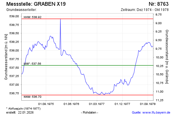
Grundwasserstand [m ü. NN]: 538,15
Flurabstand [m u. Gelände]: 9,65
Letzter Messwert vom 30.10.1978 12:00
Geländehöhe [m ü. NN]: 547,80
| Datum | Grundwasserstand [m ü. NN] |
|---|---|
| 23.10.1978 | 538,12 |
| 16.10.1978 | 538,10 |
| 09.10.1978 | 538,11 |
| 02.10.1978 | 538,16 |
| 25.09.1978 | 538,21 |
| 18.09.1978 | 538,23 |
| 11.09.1978 | 538,23 |
| 04.09.1978 | 538,23 |
© Bayerisches Landesamt für Umwelt 2025