
- Startseite >
- Grundwasser >
- Wasserstand oberes Stockwerk >
- Obere Donau >
- LANGENMOSEN T 2 >
- Aktuelle Daten

Aktuelle Daten LANGENMOSEN T 2
Grundwasserstände der letzten 12 Monate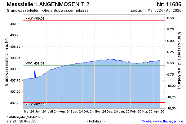
Grundwasserstand [m ü. NN]: 408,13
Flurabstand [m u. Gelände]: 9,50
Letzter Messwert vom 27.02.2025 09:00
Geländehöhe [m ü. NN]: 417,63
Datum | Grundwasserstand [m ü. NN] |
|---|---|
| 27.02.2025 | 408,13 |
| 26.02.2025 | 408,13 |
| 25.02.2025 | 408,13 |
| 24.02.2025 | 408,13 |
| 23.02.2025 | 408,12 |
| 22.02.2025 | 408,13 |
| 21.02.2025 | 408,12 |
| 20.02.2025 | 408,12 |
© Bayerisches Landesamt für Umwelt 2025