
- Startseite >
- Grundwasser >
- Wasserstand oberes Stockwerk >
- Untere Donau >
- Isarvorland P5 >
- Gesamtzeitraum

Gesamtzeitraum Isarvorland P5
Grundwasserstände im Gesamtzeitraum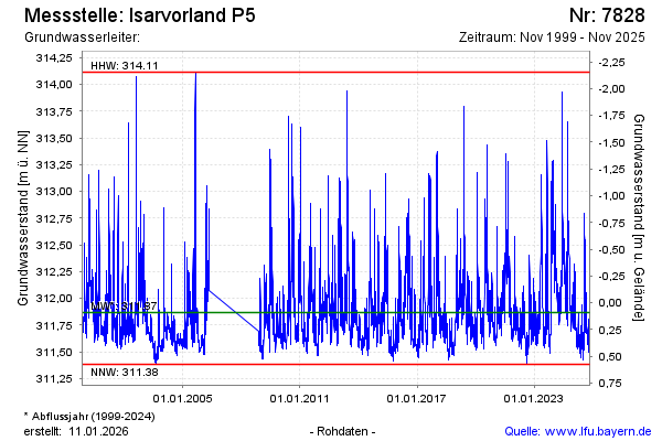
Hinweis
GW Messstelle im SN Isarvorland
Grundwasserstand [m ü. NN]: 311,77
Flurabstand [m u. Gelände]: 0,19
Letzter Messwert vom 14.11.2024 13:55
Geländehöhe [m ü. NN]: 311,96
| Datum | Grundwasserstand [m ü. NN] |
|---|---|
| 14.11.2024 | 311,75 |
| 13.11.2024 | 311,76 |
| 12.11.2024 | 311,80 |
| 11.11.2024 | 311,80 |
| 10.11.2024 | 311,84 |
| 09.11.2024 | 311,90 |
| 08.11.2024 | 311,92 |
| 07.11.2024 | 311,93 |
© Bayerisches Landesamt für Umwelt 2025