
- Startseite >
- Grundwasser >
- Quellschüttung >
- Oberer Main - Elbe >
- VILSQU.,KLEINSCHOENBR. >
- Gesamtzeitraum

Gesamtzeitraum VILSQU.,KLEINSCHOENBR.
Quellschüttungen im Gesamtzeitraum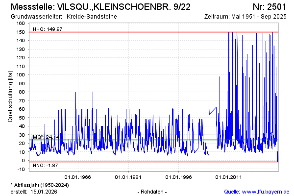
Schüttung [l/s]: 30,95
Letzter Messwert vom 14.03.2025 09:00
Geländehöhe [m ü. NN]: 455,00
| Datum | Quellschüttung [l/s] |
|---|---|
| 14.03.2025 | 30,97 |
| 13.03.2025 | 31,19 |
| 12.03.2025 | 31,14 |
| 11.03.2025 | 30,84 |
| 10.03.2025 | 31,41 |
| 09.03.2025 | 31,21 |
| 08.03.2025 | 30,43 |
| 07.03.2025 | 30,32 |
© Bayerisches Landesamt für Umwelt 2025