
- Startseite >
- Grundwasser >
- Quellschüttung >
- Untere Donau >
- Helchenbach 18/2 >
- Gesamtzeitraum

Gesamtzeitraum Helchenbach 18/2
Quellschüttungen im Gesamtzeitraum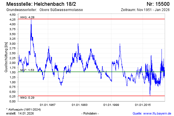
Schüttung [l/s]: 1,66
Letzter Messwert vom 30.12.2024 10:00
Geländehöhe [m ü. NN]: 419,60
| Datum | Quellschüttung [l/s] |
|---|---|
| 30.12.2024 | 1,70 |
| 29.12.2024 | 1,71 |
| 28.12.2024 | 1,71 |
| 27.12.2024 | 1,79 |
| 26.12.2024 | 1,80 |
| 25.12.2024 | 1,72 |
| 24.12.2024 | 1,73 |
| 23.12.2024 | 1,73 |
© Bayerisches Landesamt für Umwelt 2025