
- Startseite >
- Grundwasser >
- Wasserstand tiefere Stockwerke >
- Inn >
- BRUNNEN I FÜRSTBERG >
- Gesamtzeitraum

Gesamtzeitraum BRUNNEN I FÜRSTBERG
Grundwasserstände im Gesamtzeitraum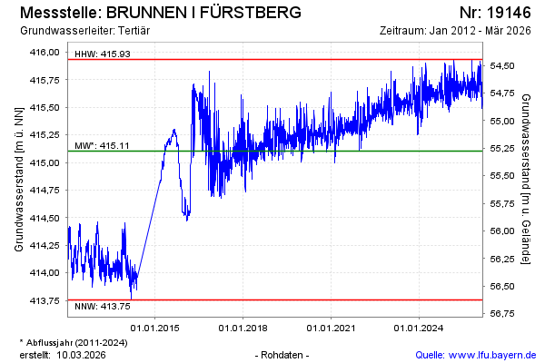
Grundwasserstand [m ü. NN]: 415,69
Flurabstand [m u. Gelände]: 54,69
Letzter Messwert vom 17.02.2025 08:00
Geländehöhe [m ü. NN]: 470,38
| Datum | Grundwasserstand [m ü. NN] |
|---|---|
| 17.02.2025 | 415,70 |
| 16.02.2025 | 415,73 |
| 15.02.2025 | 415,69 |
| 14.02.2025 | 415,71 |
| 13.02.2025 | 415,76 |
| 12.02.2025 | 415,72 |
| 11.02.2025 | 415,68 |
| 10.02.2025 | 415,66 |
© Bayerisches Landesamt für Umwelt 2025