
- Startseite >
- Grundwasser >
- Wasserstand tiefere Stockwerke >
- Isar >
- PASTETTEN T 13 >
- Gesamtzeitraum

Gesamtzeitraum PASTETTEN T 13
Grundwasserstände im Gesamtzeitraum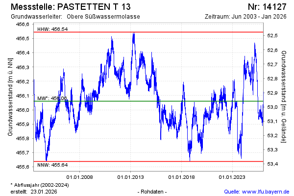
Grundwasserstand [m ü. NN]: 456,34
Flurabstand [m u. Gelände]: 52,68
Letzter Messwert vom 21.02.2025 10:00
Geländehöhe [m ü. NN]: 509,02
| Datum | Grundwasserstand [m ü. NN] |
|---|---|
| 23.02.2025 | 456,34 |
| 22.02.2025 | 456,35 |
| 21.02.2025 | 456,34 |
| 20.02.2025 | 456,33 |
| 19.02.2025 | 456,34 |
| 18.02.2025 | 456,33 |
| 17.02.2025 | 456,34 |
| 16.02.2025 | 456,35 |
© Bayerisches Landesamt für Umwelt 2025