
- Startseite >
- Grundwasser >
- Wasserstand tiefere Stockwerke >
- Obere Donau >
- Ammerfeld, B1 >
- Gesamtzeitraum

Gesamtzeitraum Ammerfeld, B1
Grundwasserstände im Gesamtzeitraum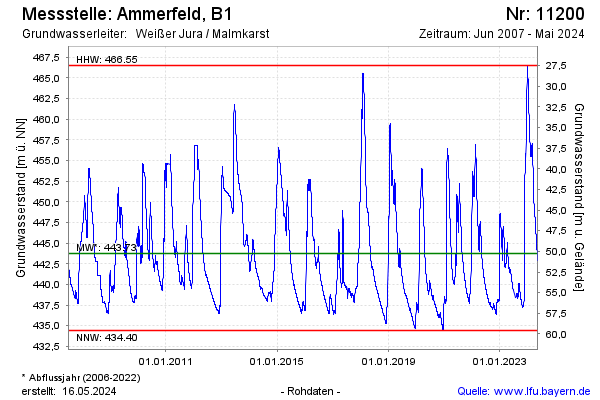
Grundwasserstand [m ü. NN]: 450,34
Flurabstand [m u. Gelände]: 43,66
Letzter Messwert vom 02.03.2025 07:00
Geländehöhe [m ü. NN]: 494,00
Datum | Grundwasserstand [m ü. NN] |
|---|---|
| 01.03.2025 | 450,55 |
| 28.02.2025 | 450,83 |
| 27.02.2025 | 451,11 |
| 26.02.2025 | 451,37 |
| 25.02.2025 | 451,63 |
| 24.02.2025 | 451,84 |
| 23.02.2025 | 452,04 |
| 22.02.2025 | 452,24 |
© Bayerisches Landesamt für Umwelt 2025