
- Start >
- Groundwater >
- Waterlevel of deep layer >
- Bayern >
- Achering T 9t >
- Current data

Current data Achering T 9t
Groundwater levels of the last 12 months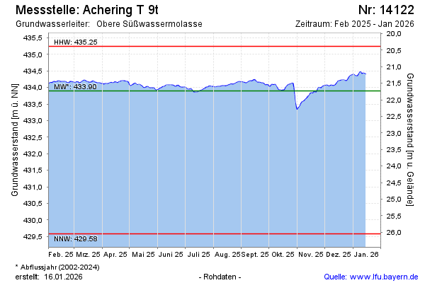
Groundwater level [m above sealevel]: 432.09
Distance to surface [m]: 23.54
Last value from 23.11.2024 09:00
Ground level [m above sealevel]: 455.63
| Date | Groundwater level [m above sealevel] |
|---|---|
| 23.11.2024 | 432.08 |
| 22.11.2024 | 432.06 |
| 21.11.2024 | 431.97 |
| 20.11.2024 | 431.86 |
| 19.11.2024 | 431.74 |
| 18.11.2024 | 431.58 |
| 17.11.2024 | 431.43 |
| 16.11.2024 | 431.25 |
© Bayerisches Landesamt für Umwelt 2024