
- Start >
- Groundwater >
- Waterlevel of deep layer >
- Bayern >
- ADELSRIED TA 1-T2 >
- Current data

Current data ADELSRIED TA 1-T2
Groundwater levels of the last 12 months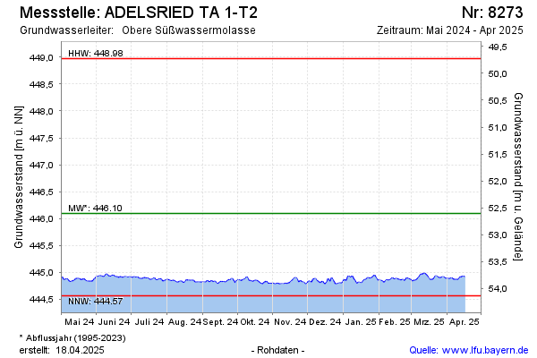
Groundwater level [m above sealevel]: 444.89
Distance to surface [m]: 53.81
Last value from 19.11.2024 14:00
Ground level [m above sealevel]: 498.70
| Date | Groundwater level [m above sealevel] |
|---|---|
| 19.11.2024 | 444.87 |
| 18.11.2024 | 444.84 |
| 17.11.2024 | 444.84 |
| 16.11.2024 | 444.81 |
| 15.11.2024 | 444.79 |
| 14.11.2024 | 444.79 |
| 13.11.2024 | 444.78 |
| 12.11.2024 | 444.79 |
© Bayerisches Landesamt für Umwelt 2024