
- Start >
- Groundwater >
- Waterlevel of deep layer >
- Bayern >
- Ammerfeld, B1 >
- Chart of total period

Chart of total period Ammerfeld, B1
Groundwater levels of the total period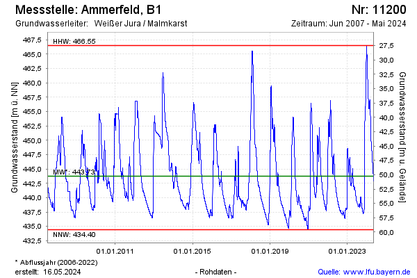
Groundwater level [m above sealevel]: 444.17
Distance to surface [m]: 49.83
Last value from 27.07.2024 06:00
Ground level [m above sealevel]: 494.00
| Date | Groundwater level [m above sealevel] |
|---|---|
| 26.07.2024 | 444.29 |
| 25.07.2024 | 444.42 |
| 24.07.2024 | 444.54 |
| 23.07.2024 | 444.66 |
| 22.07.2024 | 444.78 |
| 21.07.2024 | 444.92 |
| 20.07.2024 | 445.00 |
| 19.07.2024 | 445.03 |
© Bayerisches Landesamt für Umwelt 2024