
- Start >
- Groundwater >
- Waterlevel of deep layer >
- Bayern >
- AUTOBAHN WÖRTH/ISAR W3 >
- Year chart of precipitation

Year chart of precipitation AUTOBAHN WÖRTH/ISAR W3
Groundwater levels of the last 12 months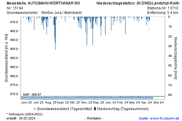
Groundwater level [m above sealevel]: 368,33
Distance to surface [m]: 5,46
Last value from 19.11.2024 10:00
Ground level [m above sealevel]: 373.79
© Bayerisches Landesamt für Umwelt 2024