
- Start >
- Groundwater >
- Waterlevel of deep layer >
- Bayern >
- Bischofsheim S2 >
- Chart of total period

Chart of total period Bischofsheim S2
Groundwater levels of the total period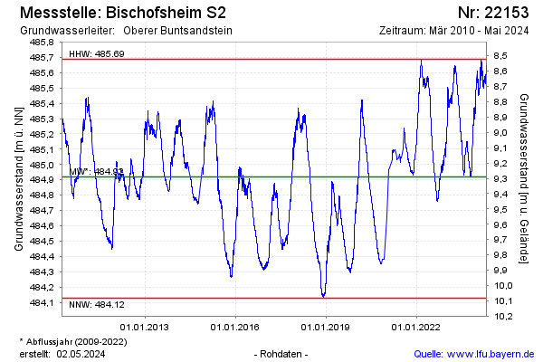
Groundwater level [m above sealevel]: 484.77
Distance to surface [m]: 9.55
Last value from 07.01.2026 10:00
Ground level [m above sealevel]: 494.32
| Date | Groundwater level [m above sealevel] |
|---|---|
| 06.01.2026 | 484.78 |
| 05.01.2026 | 484.78 |
| 04.01.2026 | 484.79 |
| 03.01.2026 | 484.80 |
| 02.01.2026 | 484.82 |
| 01.01.2026 | 484.82 |
| 31.12.2025 | 484.81 |
| 30.12.2025 | 484.81 |
© Bayerisches Landesamt für Umwelt 2026