
- Start >
- Groundwater >
- Waterlevel of deep layer >
- Bayern >
- Flugplatz Manching >
- Current data

Current data Flugplatz Manching
Groundwater levels of the last 12 months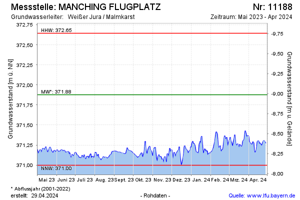
note
Datensammler defekt
Groundwater level [m above sealevel]: 371.30
Distance to surface [m]: -8.41
Last value from 24.11.2024 07:00
Ground level [m above sealevel]: 362.89
| Date | Groundwater level [m above sealevel] |
|---|---|
| 23.11.2024 | 371.30 |
| 22.11.2024 | 371.40 |
| 21.11.2024 | 371.43 |
| 20.11.2024 | 371.43 |
| 19.11.2024 | 371.42 |
| 18.11.2024 | 371.36 |
| 17.11.2024 | 371.35 |
| 16.11.2024 | 371.31 |
© Bayerisches Landesamt für Umwelt 2024