
- Start >
- Groundwater >
- Waterlevel of deep layer >
- Bayern >
- GUNGOLDING 928 >
- Current data

Current data GUNGOLDING 928
Groundwater levels of the last 12 months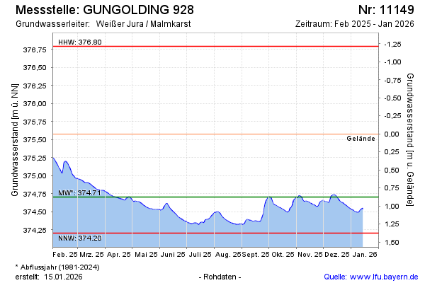
note
Messstelle defekt
Groundwater level [m above sealevel]: 374.97
Distance to surface [m]: 0.61
Last value from 02.12.2024 13:00
Ground level [m above sealevel]: 375.58
| Date | Groundwater level [m above sealevel] |
|---|---|
| 02.12.2024 | 374.97 |
| 01.12.2024 | 374.98 |
| 30.11.2024 | 374.99 |
| 29.11.2024 | 374.99 |
| 28.11.2024 | 374.97 |
| 27.11.2024 | 374.94 |
| 26.11.2024 | 374.92 |
| 25.11.2024 | 374.91 |
© Bayerisches Landesamt für Umwelt 2024