
- Start >
- Groundwater >
- Waterlevel of deep layer >
- Bayern >
- HAINDLFING T 4 >
- Current data

Current data HAINDLFING T 4
Groundwater levels of the last 12 months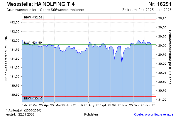
Groundwater level [m above sealevel]: 431.85
Distance to surface [m]: 29.51
Last value from 01.03.2025 10:00
Ground level [m above sealevel]: 461.36
| Date | Groundwater level [m above sealevel] |
|---|---|
| 01.03.2025 | 431.86 |
| 28.02.2025 | 431.86 |
| 27.02.2025 | 431.87 |
| 26.02.2025 | 431.88 |
| 25.02.2025 | 431.89 |
| 24.02.2025 | 431.88 |
| 23.02.2025 | 431.86 |
| 22.02.2025 | 431.88 |
© Bayerisches Landesamt für Umwelt 2025