
- Start >
- Groundwater >
- Waterlevel of deep layer >
- Bayern >
- HENGERSBERG BR I >
- Chart of total period

Chart of total period HENGERSBERG BR I
Groundwater levels of the total period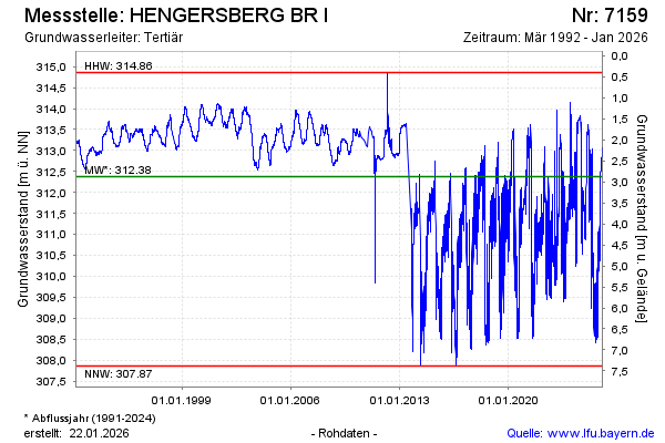
note
GW Messstelle im Verdichtungsnetz
Groundwater level [m above sealevel]: 311.72
Distance to surface [m]: 3.53
Last value from 19.11.2024 20:00
Ground level [m above sealevel]: 315.25
| Date | Groundwater level [m above sealevel] |
|---|---|
| 19.11.2024 | 311.47 |
| 18.11.2024 | 311.31 |
| 17.11.2024 | 311.22 |
| 16.11.2024 | 311.06 |
| 15.11.2024 | 311.31 |
| 14.11.2024 | 310.91 |
| 13.11.2024 | 311.00 |
| 12.11.2024 | 311.07 |
© Bayerisches Landesamt für Umwelt 2024