
- Start >
- Groundwater >
- Waterlevel of deep layer >
- Bayern >
- HOHENRAUNAU 798 >
- Chart of total period

Chart of total period HOHENRAUNAU 798
Groundwater levels of the total period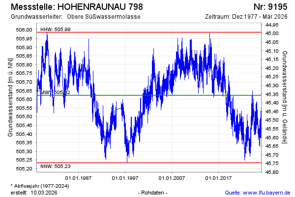
Groundwater level [m above sealevel]: 505.41
Distance to surface [m]: 45.57
Last value from 13.01.2025 06:00
Ground level [m above sealevel]: 550.98
| Date | Groundwater level [m above sealevel] |
|---|---|
| 12.01.2025 | 505.44 |
| 11.01.2025 | 505.48 |
| 10.01.2025 | 505.50 |
| 09.01.2025 | 505.56 |
| 08.01.2025 | 505.55 |
| 07.01.2025 | 505.54 |
| 06.01.2025 | 505.57 |
| 05.01.2025 | 505.55 |
© Bayerisches Landesamt für Umwelt 2025