
- Start >
- Groundwater >
- Waterlevel of deep layer >
- Bayern >
- IHRLERSTEIN TIEF K1 >
- Chart of total period

Chart of total period IHRLERSTEIN TIEF K1
Groundwater levels of the total period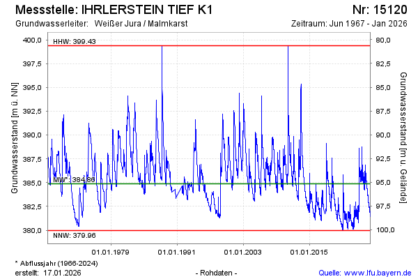
Groundwater level [m above sealevel]: 386.21
Distance to surface [m]: 93.82
Last value from 12.01.2025 10:00
Ground level [m above sealevel]: 480.03
| Date | Groundwater level [m above sealevel] |
|---|---|
| 12.01.2025 | 386.22 |
| 11.01.2025 | 386.15 |
| 10.01.2025 | 385.61 |
| 09.01.2025 | 384.89 |
| 08.01.2025 | 384.60 |
| 07.01.2025 | 384.33 |
| 06.01.2025 | 384.34 |
| 05.01.2025 | 384.32 |
© Bayerisches Landesamt für Umwelt 2025