
- Start >
- Groundwater >
- Waterlevel of deep layer >
- Bayern >
- Illertissen T 12 >
- Chart of total period

Chart of total period Illertissen T 12
Groundwater levels of the total period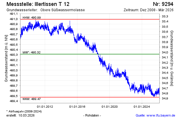
Groundwater level [m above sealevel]: 489.64
Distance to surface [m]: 34.71
Last value from 23.11.2024 10:00
Ground level [m above sealevel]: 524.35
| Date | Groundwater level [m above sealevel] |
|---|---|
| 23.11.2024 | 489.65 |
| 22.11.2024 | 489.71 |
| 21.11.2024 | 489.74 |
| 20.11.2024 | 489.73 |
| 19.11.2024 | 489.72 |
| 18.11.2024 | 489.68 |
| 17.11.2024 | 489.68 |
| 16.11.2024 | 489.65 |
© Bayerisches Landesamt für Umwelt 2024