
- Start >
- Groundwater >
- Waterlevel of deep layer >
- Bayern >
- KARLSHULD T 6 >
- Current data

Current data KARLSHULD T 6
Groundwater levels of the last 12 months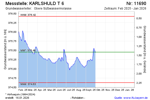
Groundwater level [m above sealevel]: 375.90
Distance to surface [m]: 0.97
Last value from 09.10.2024 16:00
Ground level [m above sealevel]: 376.87
| Date | Groundwater level [m above sealevel] |
|---|---|
| 09.10.2024 | 375.88 |
| 08.10.2024 | 375.81 |
| 07.10.2024 | 375.84 |
| 06.10.2024 | 375.87 |
| 05.10.2024 | 375.90 |
| 04.10.2024 | 375.88 |
| 03.10.2024 | 375.92 |
| 02.10.2024 | 375.93 |
© Bayerisches Landesamt für Umwelt 2025