
- Start >
- Groundwater >
- Waterlevel of deep layer >
- Bayern >
- KNELLENDORF VB C 170 >
- Chart of total period

Chart of total period KNELLENDORF VB C 170
Groundwater levels of the total period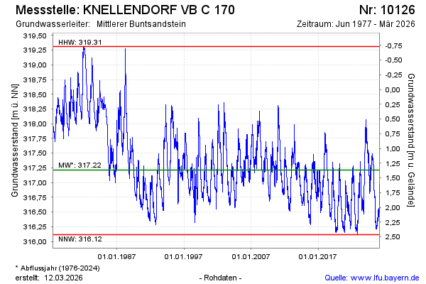
Groundwater level [m above sealevel]: 317.38
Distance to surface [m]: 1.20
Last value from 21.02.2025 10:00
Ground level [m above sealevel]: 318.58
| Date | Groundwater level [m above sealevel] |
|---|---|
| 24.02.2025 | 317.36 |
| 23.02.2025 | 317.36 |
| 22.02.2025 | 317.38 |
| 21.02.2025 | 317.38 |
| 20.02.2025 | 317.38 |
| 19.02.2025 | 317.39 |
| 18.02.2025 | 317.40 |
| 17.02.2025 | 317.42 |
© Bayerisches Landesamt für Umwelt 2025