
- Start >
- Groundwater >
- Waterlevel of deep layer >
- Bayern >
- Lohhof GS2 >
- Current data

Current data Lohhof GS2
Groundwater levels of the last 12 months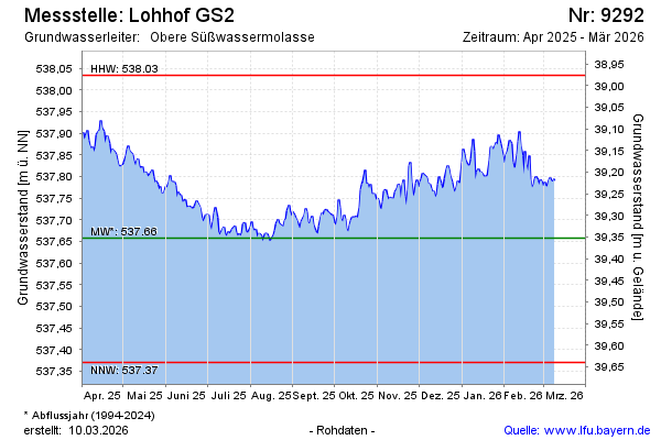
Groundwater level [m above sealevel]: 537.93
Distance to surface [m]: 39.08
Last value from 15.02.2025 09:00
Ground level [m above sealevel]: 577.01
| Date | Groundwater level [m above sealevel] |
|---|---|
| 15.02.2025 | 537.92 |
| 14.02.2025 | 537.93 |
| 13.02.2025 | 537.95 |
| 12.02.2025 | 537.96 |
| 11.02.2025 | 537.96 |
| 10.02.2025 | 537.95 |
| 09.02.2025 | 537.94 |
| 08.02.2025 | 537.95 |
© Bayerisches Landesamt für Umwelt 2025