
- Start >
- Groundwater >
- Waterlevel of deep layer >
- Bayern >
- Mauren W2 >
- Chart of total period

Chart of total period Mauren W2
Groundwater levels of the total period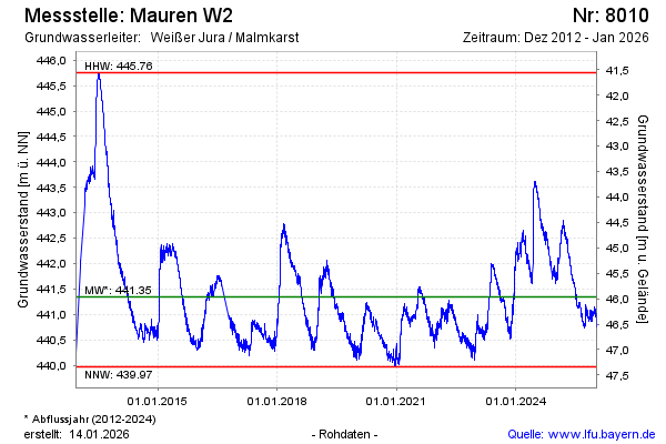
Groundwater level [m above sealevel]: 442.50
Distance to surface [m]: 44.81
Last value from 16.02.2025 07:00
Ground level [m above sealevel]: 487.31
| Date | Groundwater level [m above sealevel] |
|---|---|
| 15.02.2025 | 442.39 |
| 14.02.2025 | 442.39 |
| 13.02.2025 | 442.44 |
| 12.02.2025 | 442.42 |
| 11.02.2025 | 442.39 |
| 10.02.2025 | 442.36 |
| 09.02.2025 | 442.34 |
| 08.02.2025 | 442.36 |
© Bayerisches Landesamt für Umwelt 2025