
- Start >
- Groundwater >
- Waterlevel of deep layer >
- Bayern >
- MERTINGEN D 55 >
- Chart of total period

Chart of total period MERTINGEN D 55
Groundwater levels of the total period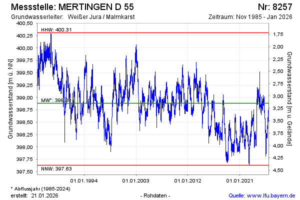
Groundwater level [m above sealevel]: 398.91
Distance to surface [m]: 3.12
Last value from 19.11.2024 09:13
Ground level [m above sealevel]: 402.03
| Date | Groundwater level [m above sealevel] |
|---|---|
| 19.11.2024 | 398.87 |
| 18.11.2024 | 398.87 |
| 17.11.2024 | 398.86 |
| 16.11.2024 | 398.82 |
| 15.11.2024 | 398.80 |
| 14.11.2024 | 398.80 |
| 13.11.2024 | 398.79 |
| 12.11.2024 | 398.80 |
© Bayerisches Landesamt für Umwelt 2024