
- Start >
- Groundwater >
- Waterlevel of deep layer >
- Bayern >
- MITTERFECKING W2 >
- Chart of total period

Chart of total period MITTERFECKING W2
Groundwater levels of the total period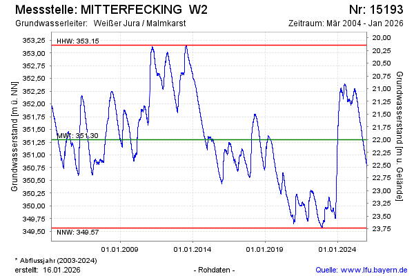
Groundwater level [m above sealevel]: 352.00
Distance to surface [m]: 21.30
Last value from 25.12.2024 10:00
Ground level [m above sealevel]: 373.30
| Date | Groundwater level [m above sealevel] |
|---|---|
| 25.12.2024 | 352.01 |
| 24.12.2024 | 352.02 |
| 23.12.2024 | 352.04 |
| 22.12.2024 | 352.05 |
| 21.12.2024 | 352.03 |
| 20.12.2024 | 352.03 |
| 19.12.2024 | 352.05 |
| 18.12.2024 | 352.03 |
© Bayerisches Landesamt für Umwelt 2024