
- Start >
- Groundwater >
- Waterlevel of deep layer >
- Bayern >
- OBERDIETENAU T 17 >
- Chart of total period

Chart of total period OBERDIETENAU T 17
Groundwater levels of the total period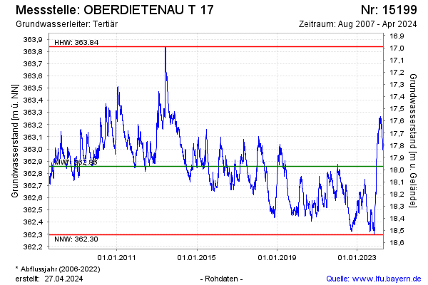
Groundwater level [m above sealevel]: 362.98
Distance to surface [m]: 17.85
Last value from 27.12.2024 10:00
Ground level [m above sealevel]: 380.83
| Date | Groundwater level [m above sealevel] |
|---|---|
| 27.12.2024 | 362.98 |
| 26.12.2024 | 362.97 |
| 25.12.2024 | 362.96 |
| 24.12.2024 | 362.98 |
| 23.12.2024 | 363.00 |
| 22.12.2024 | 363.02 |
| 21.12.2024 | 362.99 |
| 20.12.2024 | 362.99 |
© Bayerisches Landesamt für Umwelt 2024