
- Start >
- Groundwater >
- Waterlevel of deep layer >
- Bayern >
- Obergriesbach T5 >
- Current data

Current data Obergriesbach T5
Groundwater levels of the last 12 months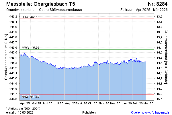
Groundwater level [m above sealevel]: 445.43
Distance to surface [m]: 14.27
Last value from 19.11.2024 09:00
Ground level [m above sealevel]: 459.70
| Date | Groundwater level [m above sealevel] |
|---|---|
| 19.11.2024 | 445.42 |
| 18.11.2024 | 445.40 |
| 17.11.2024 | 445.39 |
| 16.11.2024 | 445.37 |
| 15.11.2024 | 445.35 |
| 14.11.2024 | 445.35 |
| 13.11.2024 | 445.35 |
| 12.11.2024 | 445.36 |
© Bayerisches Landesamt für Umwelt 2024