
- Start >
- Groundwater >
- Waterlevel of deep layer >
- Bayern >
- PIPINSRIED T2t >
- Current data

Current data PIPINSRIED T2t
Groundwater levels of the last 12 months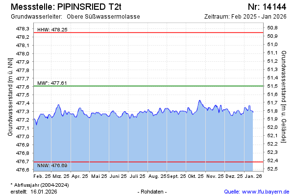
Groundwater level [m above sealevel]: 477.22
Distance to surface [m]: 51.89
Last value from 19.11.2024 09:00
Ground level [m above sealevel]: 529.11
| Date | Groundwater level [m above sealevel] |
|---|---|
| 19.11.2024 | 477.19 |
| 18.11.2024 | 477.18 |
| 17.11.2024 | 477.16 |
| 16.11.2024 | 477.14 |
| 15.11.2024 | 477.13 |
| 14.11.2024 | 477.12 |
| 13.11.2024 | 477.13 |
| 12.11.2024 | 477.13 |
© Bayerisches Landesamt für Umwelt 2024