
- Start >
- Groundwater >
- Waterlevel of deep layer >
- Bayern >
- Prügeldorf 8 >
- Chart of total period

Chart of total period Prügeldorf 8
Groundwater levels of the total period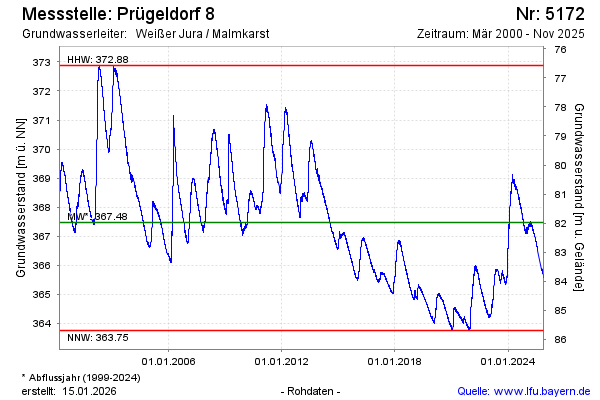
Groundwater level [m above sealevel]: 367.75
Distance to surface [m]: 81.70
Last value from 09.10.2024 12:00
Ground level [m above sealevel]: 449.45
| Date | Groundwater level [m above sealevel] |
|---|---|
| 09.10.2024 | 367.73 |
| 08.10.2024 | 367.73 |
| 07.10.2024 | 367.72 |
| 06.10.2024 | 367.71 |
| 05.10.2024 | 367.69 |
| 04.10.2024 | 367.70 |
| 03.10.2024 | 367.72 |
| 02.10.2024 | 367.77 |
© Bayerisches Landesamt für Umwelt 2024