
- Start >
- Groundwater >
- Waterlevel of deep layer >
- Bayern >
- Roggenburg T 13 >
- Current data

Current data Roggenburg T 13
Groundwater levels of the last 12 months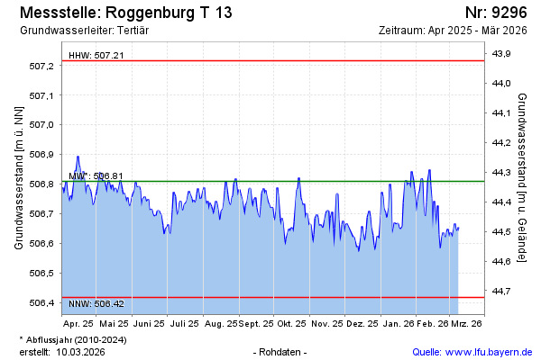
Groundwater level [m above sealevel]: 506.80
Distance to surface [m]: 44.34
Last value from 16.02.2025 11:00
Ground level [m above sealevel]: 551.14
| Date | Groundwater level [m above sealevel] |
|---|---|
| 16.02.2025 | 506.80 |
| 15.02.2025 | 506.77 |
| 14.02.2025 | 506.78 |
| 13.02.2025 | 506.82 |
| 12.02.2025 | 506.80 |
| 11.02.2025 | 506.77 |
| 10.02.2025 | 506.75 |
| 09.02.2025 | 506.74 |
© Bayerisches Landesamt für Umwelt 2025