
- Start >
- Groundwater >
- Waterlevel of deep layer >
- Bayern >
- Westheim Brunnen II >
- Current data

Current data Westheim Brunnen II
Groundwater levels of the last 12 months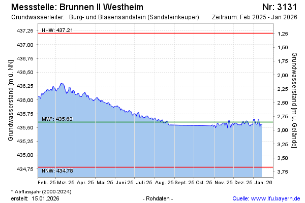
Groundwater level [m above sealevel]: 435.72
Distance to surface [m]: 2.73
Last value from 23.11.2024 13:00
Ground level [m above sealevel]: 438.45
| Date | Groundwater level [m above sealevel] |
|---|---|
| 23.11.2024 | 435.73 |
| 22.11.2024 | 435.82 |
| 21.11.2024 | 435.85 |
| 20.11.2024 | 435.84 |
| 19.11.2024 | 435.85 |
| 18.11.2024 | 435.80 |
| 17.11.2024 | 435.80 |
| 16.11.2024 | 435.78 |
© Bayerisches Landesamt für Umwelt 2024