
- Start >
- Groundwater >
- Waterlevel of deep layer >
- Bayern >
- Wettelsheim >
- Chart of total period

Chart of total period Wettelsheim
Groundwater levels of the total period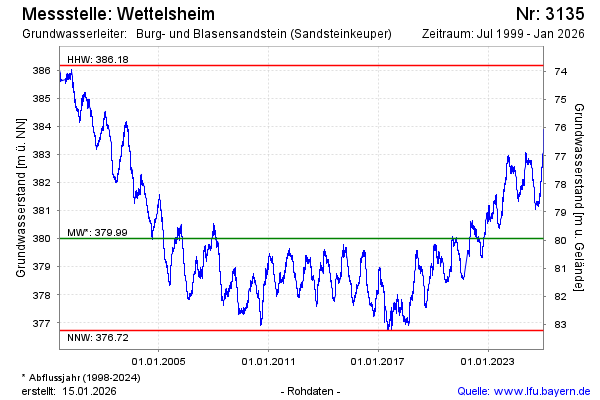
Groundwater level [m above sealevel]: 381.96
Distance to surface [m]: 77.99
Last value from 26.12.2024 13:00
Ground level [m above sealevel]: 459.95
| Date | Groundwater level [m above sealevel] |
|---|---|
| 26.12.2024 | 381.94 |
| 25.12.2024 | 381.90 |
| 24.12.2024 | 381.89 |
| 23.12.2024 | 381.95 |
| 22.12.2024 | 382.00 |
| 21.12.2024 | 381.92 |
| 20.12.2024 | 381.93 |
| 19.12.2024 | 382.03 |
© Bayerisches Landesamt für Umwelt 2024