
- Start >
- Groundwater >
- Waterlevel of deep layer >
- Bayern >
- Wieseth >
- Current data

Current data Wieseth
Groundwater levels of the last 12 months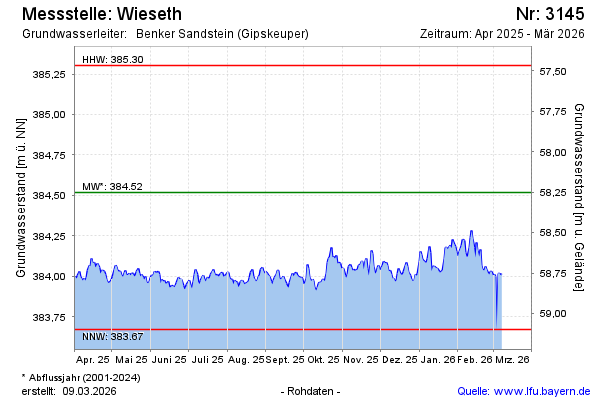
Groundwater level [m above sealevel]: 384.01
Distance to surface [m]: 58.76
Last value from 14.10.2024 13:00
Ground level [m above sealevel]: 442.77
| Date | Groundwater level [m above sealevel] |
|---|---|
| 13.10.2024 | 384.03 |
| 12.10.2024 | 384.04 |
| 11.10.2024 | 384.05 |
| 10.10.2024 | 384.13 |
| 09.10.2024 | 384.14 |
| 08.10.2024 | 384.09 |
| 07.10.2024 | 384.07 |
| 06.10.2024 | 384.06 |
© Bayerisches Landesamt für Umwelt 2024