
- Start >
- Groundwater >
- Waterlevel of deep layer >
- Bayern >
- Windsbach-Suddersdorf >
- Current data

Current data Windsbach-Suddersdorf
Groundwater levels of the last 12 months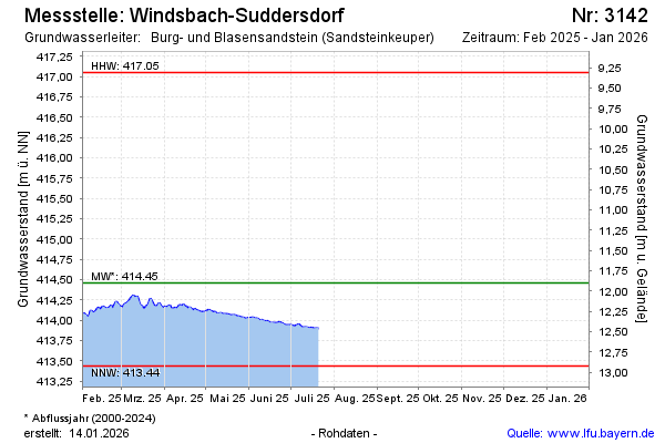
Groundwater level [m above sealevel]: 413.90
Distance to surface [m]: 12.46
Last value from 21.07.2025 10:38
Ground level [m above sealevel]: 426.36
| Date | Groundwater level [m above sealevel] |
|---|---|
| 21.07.2025 | 413.90 |
| 20.07.2025 | 413.91 |
| 19.07.2025 | 413.90 |
| 18.07.2025 | 413.90 |
| 17.07.2025 | 413.90 |
| 16.07.2025 | 413.91 |
| 15.07.2025 | 413.90 |
| 14.07.2025 | 413.90 |
© Bayerisches Landesamt für Umwelt 2025