
- Start >
- Groundwater >
- Waterlevel of deep layer >
- Isar >
- ALTDORF TIEFBOHRUNG >
- Year chart of precipitation

Year chart of precipitation ALTDORF TIEFBOHRUNG
Groundwater levels of the last 12 months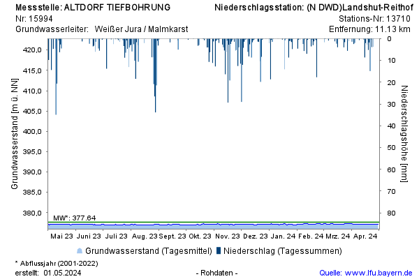
note
Keine Beobachtung von 04/2010 bis 09/2021
Groundwater level [m above sealevel]: 377,29
Distance to surface [m]: 29,49
Last value from 17.02.2025 10:00
Ground level [m above sealevel]: 406.78
© Bayerisches Landesamt für Umwelt 2025