
- Start >
- Groundwater >
- Waterlevel of deep layer >
- Isar >
- LODERBACH TB 878 >
- Chart of total period

Chart of total period LODERBACH TB 878
Groundwater levels of the total period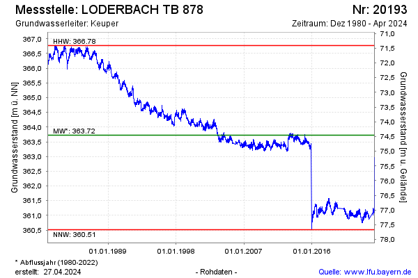
Groundwater level [m above sealevel]: 362.91
Distance to surface [m]: 75.27
Last value from 05.10.2024 10:00
Ground level [m above sealevel]: 438.18
| Date | Groundwater level [m above sealevel] |
|---|---|
| 05.10.2024 | 362.91 |
| 04.10.2024 | 362.92 |
| 03.10.2024 | 362.93 |
| 02.10.2024 | 362.95 |
| 01.10.2024 | 362.92 |
| 30.09.2024 | 362.89 |
| 29.09.2024 | 362.85 |
| 28.09.2024 | 362.89 |
© Bayerisches Landesamt für Umwelt 2024